Why Lobsters?

As we're sure most of you are wondering, where did "Wandering Lobsters" come from? To put it simply, it's a reference to an episode from the sitcom, Friends, where the character Phoebe explains her lobster theory to show how she knows Ross and Rachel were meant to be. She states, "It's a known fact that lobsters fall it love and mate for life. You can actually see old lobster couples walking around there tank holding claws." We picked up the nickname ourselves when we first started dating in college, and for whatever reason it has stuck with us since then.

Sunday, March 31, 2013

The Ancient City of Cusco

Cusco has proven to be our favorite city in South America yet!  We arrived on an overnight bus from Arequipa early in the morning. Despite being the most comfortable over night bus we have taken over the entire trip (Oltursa is the name of the bus company if you ever venture down here), neither of us slept well due to the bumpy ride.  We didn`t let this stop us from taking off right away though.
Plaza de Armas in Cusco.
Cusco overall is a very touristy town, but the streets in the downtown area are lined with cobblestone and there is a different square to hang out in with beautiful churches on almost every other corner.  Both of us had been looking forward not only to Machu Picchu, but discovering the Incan treasures in and around Cusco as well. 
We saw this on the walking tour. The Incans even put pictures in their stone work.  Do you see the snake? The largest stone in the middle looks like it has a darker spot for an eye.  Also in the stones were pictures of a puma and a condor.
While Sam took the time to rest and nap on the afternoon we arrived, I headed straight for one of the inexpensive massages off the street.  My legs were still aching from the climb out of Colca Canyon and I couldn`t think of a better remedy.  While the hour long hot stone massage that I received may not have been the caliber I would have in the U.S., it was just what I needed, and at only $8, I didn`t feel guilty at all.
The San Pedro market was one of our favorite places in Cusco.
One of my favorite things to learn about other cultures has been their typical types of food and how to make them. It just so happened that evening, the Chocolate Museum two blocks away from our hostel was hosting a Peruvian cooking night, so we signed up right away.  Not only did we learn how to make their typical dinner, we learned how to make what also became our favorite drink of the trip so far, pisco sours.  Gladys was our chef, and we started out at the local market.  Sam and I wished that we had a local market like this at home.  Not only could you buy all types of fresh ingredients, they had a section with juice bars where you could get fresh juice for just over $1.  You could buy whole meals there as well including soup and a main dish and drink for about $3.  They even had a chocolate section.
A Peruvian woman selling all sorts of item at her stand in the market.
Once we returned from the market, we got down to business in creating our dinner of the evening, alli de gallina, which is a chicken dish served over rice and potatoes. The sauce was the specialty, a creamy blend with yellow peppers and onions.  It was topped off with a delicious salad and chocolate fondu for dessert, not to mention those pisco sours.
Cusco cooking class!
Getting right down to work.
And the outcome was totally worth it.
The pisco sours topped off the meal.
More pisco sour making the next day.  We weren`t complaining!
We also took part in the free walking tour in Cusco.  I have learned while we`ve been traveling that many cities hold these, although the tour in Cusco was one of the only ones we took part in.  We were offered free samples of different types of food and drink as well as learning about some of the history of the Incas and the city of Cusco itself.  They also taught us about all the amazing things made out of alpaca and showed us how to tell the difference between real baby alpaca and the synthetic (although when we went to the market later I still felt clueless).We ended the the tour at the Picso Museum (which is really just a bar where they sell pisco) and again were taught about the history and the making of pisco sours. 
The traditional garb of the locals. I couldn´t resist taking a picture of this little girl and her llama .
For our last few days in Cusco, after returning from the Sacred Valley and Machu Picchu, we relaxed and got ready for our journey to the Galapagos. If the opporturnity ever presented itself, I would love to come back to Cusco to study spanish, which we have slowly been trying to teach ourselves during the whole trip so far.  Let`s hope our work has paid off  so far, because volunteering in the Galapagos is just about here!

(Written March 15th)


Thursday, March 28, 2013

Machu Picchu and the Sacred Valley

Machu Picchu and the Sacred Valley near Cusco, which was the heart of the Incan Empire, is said to be the archeological capital of the Americas. We knew the area was going to be interesting and very beautiful, but, from the start, it was challenging to find a way to see what we wanted to without straining our wallets.

The ruins at Moray, which are very remote but offer a great view.
Because Machu Picchu (MP) and the ruins in the Sacred Valley are so hard to get to, the most popular way to get to Machu Picchu is by an extremely expensive train, which is about $130 per person for a short ride. This is on top of the $57 ticket to get into MP, and none of this includes the inflated accommodation and food prices, getting to the other ruins, and the entrance fees for the four other sites we were visiting. After all is said and done, visiting the heart of the Incan empire was going to be very expensive, but we had a couple tricks up our sleeves.

Me climbing on the steps at Moray.
Of course, we could have just booked with a tour company and had them shuttle us around and take care of everything, which is what most people choose to do. We heard from other travelers and online forums that there is a back-way to get to MP that is cheaper, but much more convoluted and more time-consuming. We decided to go for it, and headed off for our first set of ruins near the small town of Pisac.

Pisac ruins in the side of the mountain.
Chinchero ruins, with some impressive terracing.
We decided to really try and experience the culture on this trip so we ate at the markets where the locals eat. This is not only AWESOME food, but it's also cheaper than at restaraunts. After arriving in Pisac by public bus, we began the steep hike up to the ruins near the town. They offered great views of the surrounding countryside and were very intact considering where they were built. They even carved out a tunnel that is about 50 feet long out of solid rock (without metal tools)!

Ollantaytambo...a mouthful to say. These were a huge set of ruins in the side of mountain.
After a quick night in Pisac, we had a long day ahead of us the next day. We visited 3 different sites. The first, Chinchero, was a couple hours away by bus and was mostly large terracing and a few buildings. Chinchero didn't take long and we were off to the remote site of Moray. These were very cool ruins and consisted of a terracing down into a bowl shaped valley. We hiked to the bottom and back up in only 40 minutes, since the taxi driver said that's all he wanted to wait. The last ruins of the day were Ollantaytambo in the town with the same name. This is also where the Incan Trail starts and where many people take the train straight to MP. We found a hostel and set off to the ruins which were just on the edge of town set into a hill. These were by far the most extensive ruins we had visiting thus far and our favorite of the 4 in the Sacred Valley. The stonework was just incredible!

After a night in Ollantaytambo, we departed on our journey to MP by bus. We had to travel about 3-4 hours to a small town on the other side of MP, then took a taxi to another small town on a road similar to the "Death Road" in Bolivia, then another taxi to a hydroelectric dam, and then hiked 2.5 hours to the town of Aguas Calientes that everyone stays at before seeing MP. It was definitely complicated, but it offered tons of views that the train doesn't. We grabbed another hostel and got to bed early in preparation for hiking up to MP at 4 am (instead of the taking the bus...).

We woke up to a downpour and quickly gave in to a one-way bus ride to the top of MP. It rained almost the entire way to the top and even on the climb up Wayna Picchu, which is the nearby mountain with ruins that offers great views back to MP. Only 400 people per day are allowed to climb Wayna Picchu because of the erosion caused by the traffic. Some experts say a catastrophic landslide could occur at any time and devastate the ruins on the mountain. It is an incredibly steep climb, and the rain only made it that much harder. It's surprising more people don't get hurt climbing it. After getting some decent pictures between the clouds and fog, we descended Wayna and began exploring MP.

The fog and rain made it difficult to get good pictures of MP from Wayna Picchu.
MP was only a town of about 600 people, so it was nothing compared to the city of Cusco, but it is so intact, it really gives a sense of how the Incans lived and survived in that extreme terrain. All the stonework is so perfect that it has lasted through some devastating earthquakes that modern some construction has succumbed to. It is not all that different from modern cities, though. There were industrial, residential, and spiritual areas. The guard tower at the highest point gave them the best view of any attackers from the valleys below.

Erin living it up with Wayna Picchu in the background.
We are near the astronomical observatory with the residential area in the background.
It's hard to imagine what Hiram Bingham, who "discovered" MP, felt when he stumbled on this.
After 6 hours at MP (6 am - noon), we were tired, but still had the hour and a half hike down the mountain to Aguas Calientes. Afterwards, we decided we were still fresh enough to make the hike back along the railroad tracks to the small town of Santa Teresa, where there were better hot springs than at Aguas Calientes. We hiked to the springs the next morning only to find they were cleaning them over the next several hours. We didn't have time to wait around since we had to get all the way back to Cusco that day. One disadvantage of taking public transport is that it is time consuming since you have wait on other passengers, but we did the reverse route and were back in Cusco by late afternoon.

The view along the tracks heading away from MP.
We knew taking the back way to MP was going to be an adventure, and we would definitely not do it any other way. The people there are extremely friendly and there were plenty of other backpackers doing the same route we were. My blood pressure was a bit high on the ride out to MP through the mountains because our driver, who I nicknamed Mario after Mario Andretti, was driving the minivan like an Indycar. I learned my lesson on the way back and just tried (not successfully) to sleep through the mountains. Apart from this, the Sacred Valley and Machu Picchu were incredible. It was hard not feeling like we were paying more than we should in some places, because we are tourists, but helping the local economy preserve this amazing place is something that put us at ease.

(Written March 13th)


Saturday, March 23, 2013

Peru's Canyon Country

Although we had never heard of Arequipa before visiting Peru, it is Peru's second largest city.  We arrived with some anxiety over hearing of tourists being ripped off by taxis. All the taxi cars looked the same to us, making it difficult to pick the official taxi drivers out of a crowd. Luckily, we made it to the hostel near Plaza de Armas without a problem and settled in. Every city in Peru seems to have a Plaza de Armas, no matter how big or small. Even the very smallest towns in the middle nowhere seemed to have one, and Arequipa's was pretty great, despite the rainy days we spent there.

The main cathedral in the Plaza de Armas stands out in the gloomy weather.
The main attraction in Arequipa was the Monastery of Santa Catalina.  We were both a little skeptical when we arrived, but the monastery proved to be an entire city within a city.  It was founded all the way back in the 16th century and is still actively functioning today, although much smaller.  Most of the many acres of cobblestone and colorful buildings are no longer used, but gave us a great insight to how they lived in those times.  Many of the nuns´ cells, or bedroom quarters, were still set up, and we couldn´t keep track of the number of kitchens and courtyards.

One of the old rooms that served as a nun´s quarters.
Bright blue courtyard inside the convent.
Near Arequipa are the two deepest canyons in the world, Colca Canyon and Cotahausi Canyon. Both claim to be the deepest in the world, and although we read the Cotahausi beats Colca by about 550 feet. Either way, they are both twice as deep as the Grand Canyon! We struggled for a long time to determine which canyon to trek. Although we heard that Colca was much more tourist driven than Cotahausi, we didn't feel up for the 12-hour overnight bus ride on dirt roads that Cotahausi required (we had enough of that in Uganda).

The Cross of the Condor as we passed it on the bus.
So after a day of preparation, we headed out on a morning bus to the main trekking town in Colca Canyon, Cabanaconde. I can see why this canyon is tourist driven, because even the veiws from the bus were not to be missed. We immediately started the 2 hour trek down to the bottom of the canyon, and we made a few friends along the way that followed us all the way down...two of the stray dogs in town. Since we left in the afternoon, we got caught in the rain for the last part of the hike, but since it was much warmer than Torres del Paine in Chile, it wasn't so bad. We made it to Oasis Sangalle around 4:30 pm. We decided not to camp on this trek due to the afternoon and evening rains, so we stayed at a small local hostel, instead, which with a pool. We only paid $8 for each night in the canyon, but one downside is that none of them have hot water. We were just glad for a hot meal and a dry bed, though.

Our hiking friend, one of the stray dogs in town. Who knows how many times he´s been down in the canyon.

A look down at the small village of Oasis Sangalle.
Then next day we were up and off to the next site, starting out with about an hour and a half climb. We decided on the less travelled route to Llahaur because we were told there were natural hot springs. This took us to see the other side of the canyon, with gorgeous views from a lookout about halfway there. Although we never made it to Cross of the Condors, a perfect veiwing spot in the canyon for the famous birds, we saw them flying through the canyon as we hiked. Unfortunately, we found out when we arrived at the small village that the hot springs can´t be used during the wet season becuase the river in the canyon rises so much that it covers the hot springs.  I was very disappointed after a long day of hiking. We took that time to rest up though, becuase we had a heck of a climb out of the canyon the next day. We had descended over 4000 feet into the canyon, and we made it back up in just over 5 grueling hours on the third day. I vowed that this would be the last trekking of our trip!
All smiles on the way down on the first day.
One of the condors stands out against the clouds that were predicting rain.

Getting a great view of the other side of the canyon.
We wanted to head back to the village at the entrance of the canyon, Chivay, as soon as we made it out of the canyon. They also have natural hot springs and I wasn't going to miss out this time. That's when we learned about the landslide that had happened almost as soon as we came into the canyon. The only road leading out of the canyon was completely gone for about 150 feet. The bus that was supposed to take us out was never coming. Instead, we hitched a ride with a truck driver to take us to the missing road. Thankfully, they were letting people climb up and around the road so that we could catch a minibus to town.


Not a bad view from the hotspings just outside of Chivay.
The next morning, we soaked our sore muscles in the hot springs in Chivay for a couple hours before catching a ride back to Arequipa. We were surprised to hear that Colca Canyon was so tourist driven because we rarely saw anyone else on the trail. We were also the only people in the hot springs besides the locals. We are sure it is quite different during dry season when tourism peaks, but I wouldn't have given up our peaceful time in Colca Canyon for anything!

(Written on March 2nd)


Tuesday, March 5, 2013

The Highest Navigable Lake in the World - Lake Titicaca

After spending several weeks in southern South America, it was time to head north to Bolivia and then Peru. We had originally planned to tour Salar de Uyuni, the famous salt flats where it is completely flat as far as the eyes can see, but since it's the wet season, we decided it would be best to hold off. We flew from Argentina through Chile and on to La Paz, Bolivia.

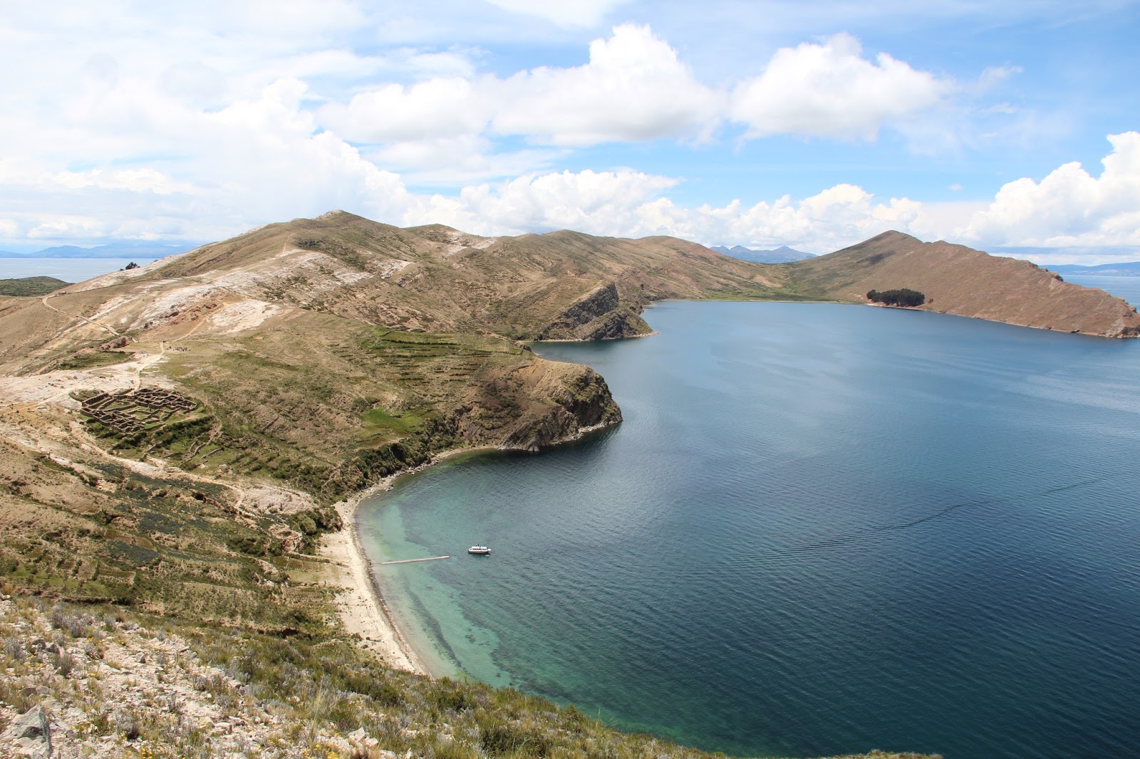
Awesome views from the highest point on Isla del Sol on Lake Titicaca.
On a side note, many countries in South America charge a reciprocity fee for entering their country. This directly corresponds to the amount it cost their citizens to get visas in the U.S. Since we where flying through Chile and had one domestic flight, we were charged the $160 per person even though we didn't want a visa and never even left the airport....Complete bullshit. I even got the border agents to agree with me on this. While I know it stems from our own U.S. government charging outrageous amounts for foreign visas, it doesn't make it any more fair in our situation. Everyone traveling to South America (and some in Africa) should be aware of this, especially Argentina, Brazil, Chile, and Bolivia. These can put a good size dent in a budget if not planned for.

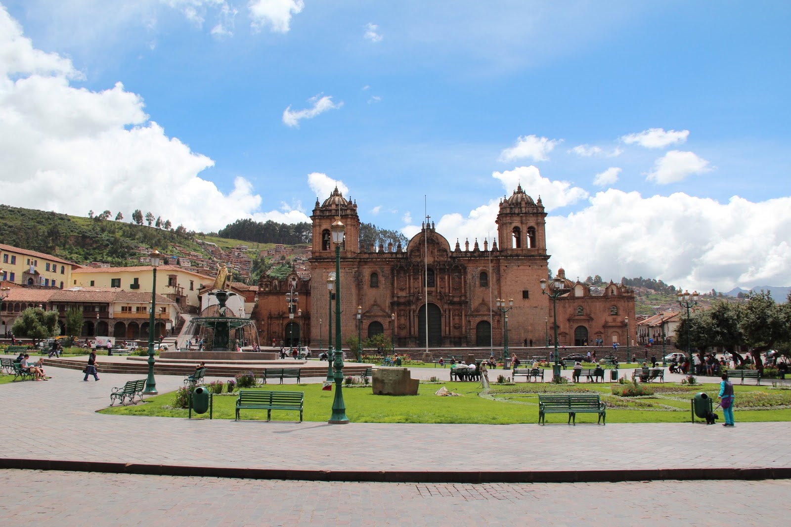
Back on point. We arrived in La Paz and could immediately feel the effects of the high altitude off the plane. Even climbing a small flight of stairs can get you huffing and puffing, not to mention while carrying our packs. We only spent that first night in La Paz before catching a bus to Copacabana, a small town on Lake Titicaca, which is considered the highest navigable lake in the world and the largest in South America.

We arrived in Copacabana with expectations of seeing the Isla del Sol, an island on the lake where there are many ruins, the following day. Erin had a headache all day which turned worse that night. I quickly became a self-proclaimed expert on Altitude Sickness with the help of the Internet and a medical research paper. Her nausea, headache, and fatigue got better throughout the night so luckily a trip to the hospital never materialized.

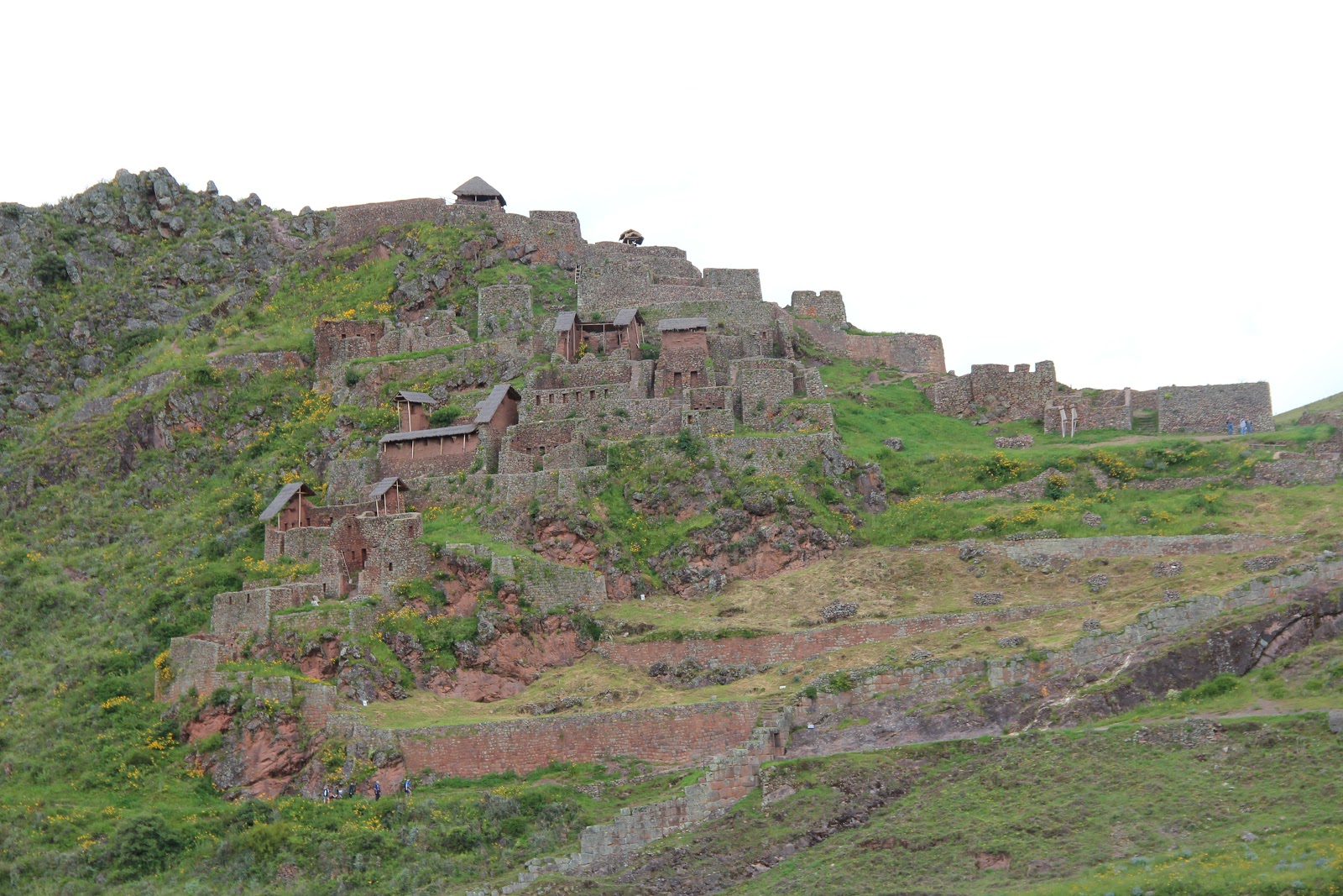
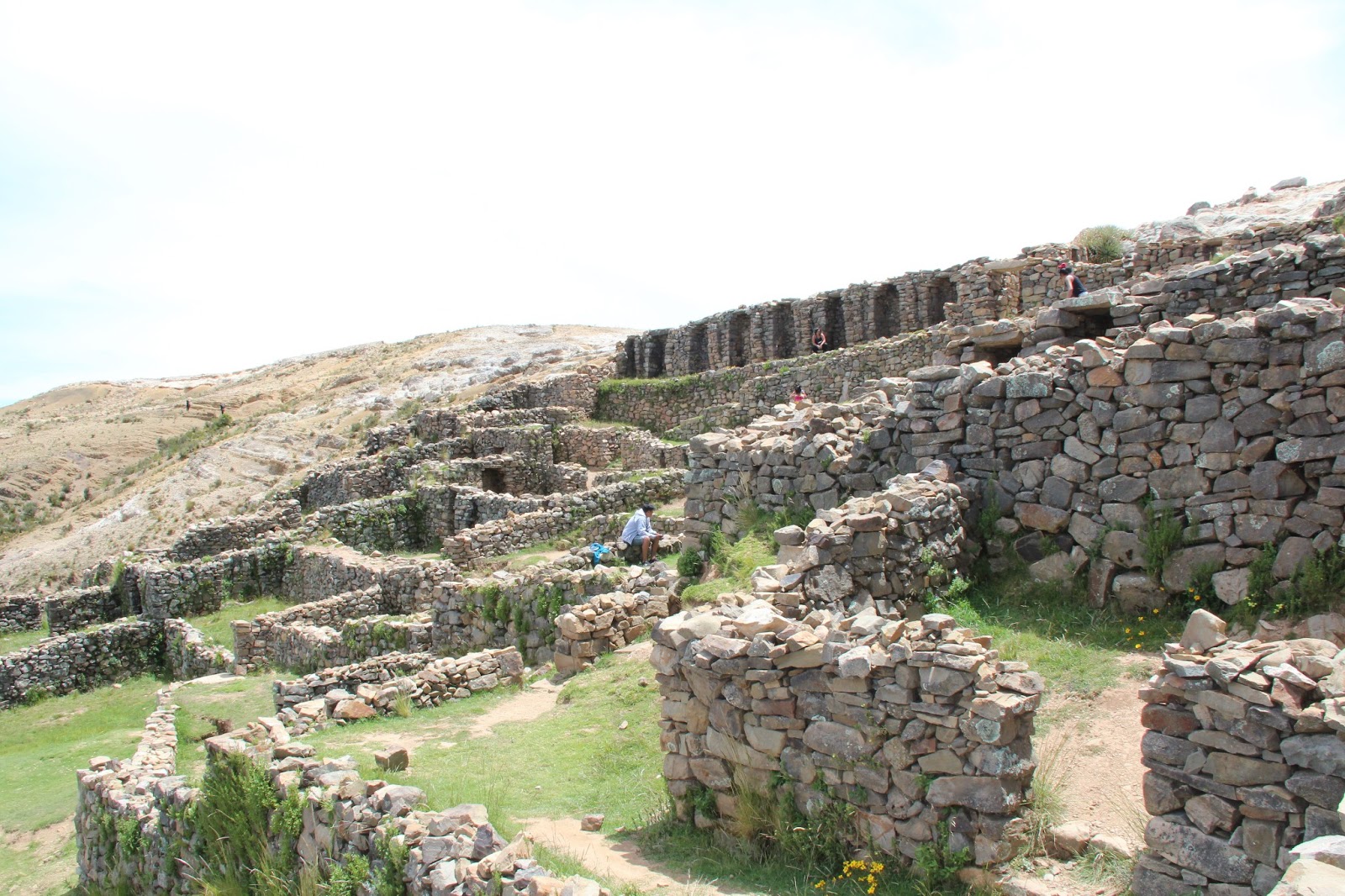
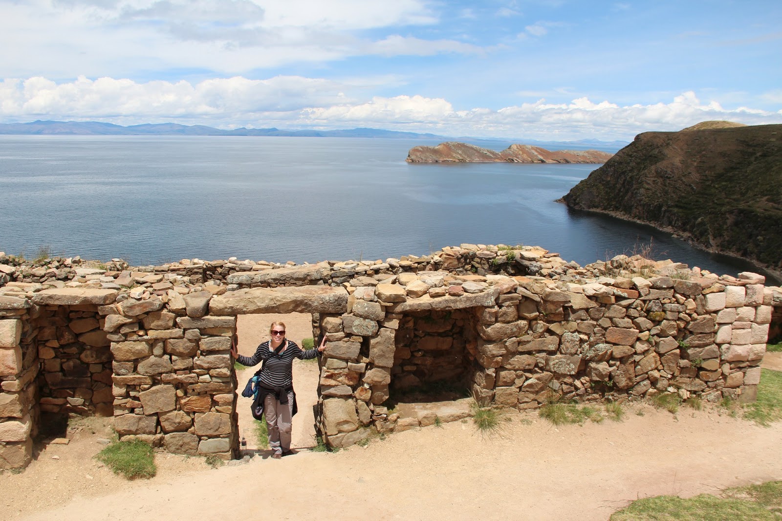
Erin insisted she was okay to do some of the hiking on Isla del Sol the next morning so we took the 2 hour ferry to get there. We took it nice and easy on the hike to the ruins and had a successful day without many surprises. The ruins were surprisingly intact and there were plenty of great views along the way.

Ruins on Isla del Sol.
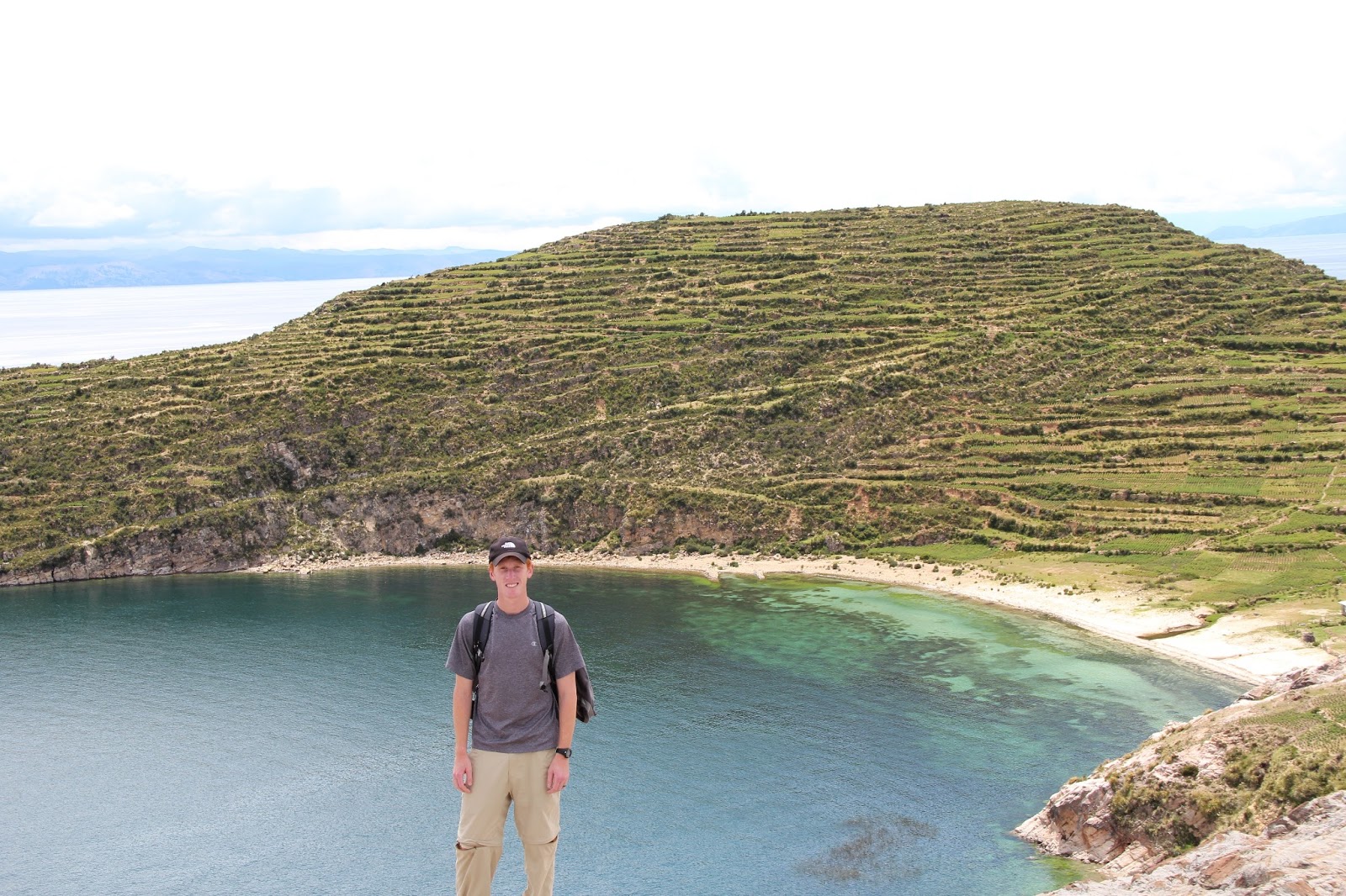
Terracing was everywhere. This was done so the steep slopes could be farmed.
The ruins were quite extensive on the island.
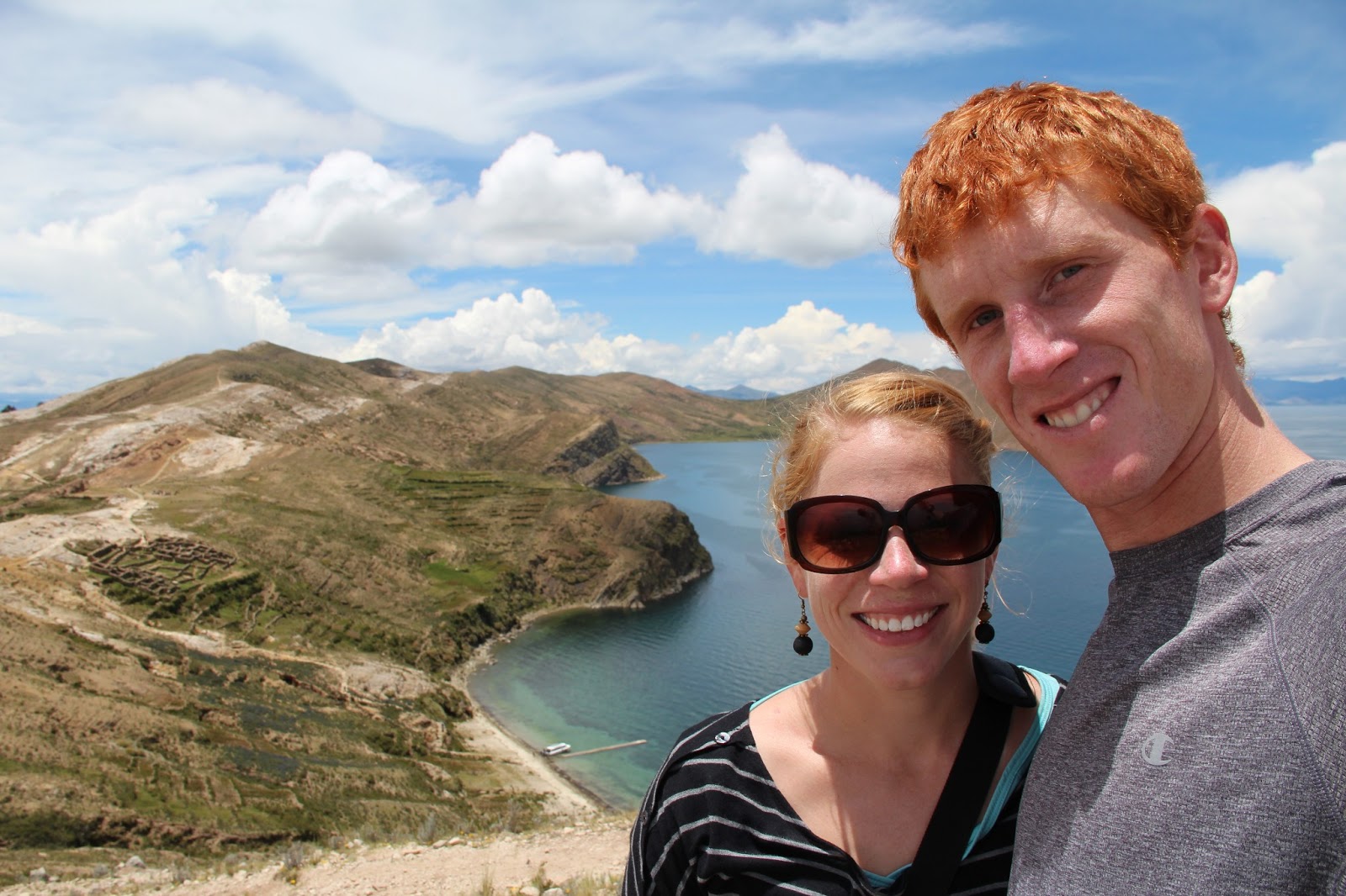
Despite the headache and fatigue, we managed to climb to the highest point for some awesome views.
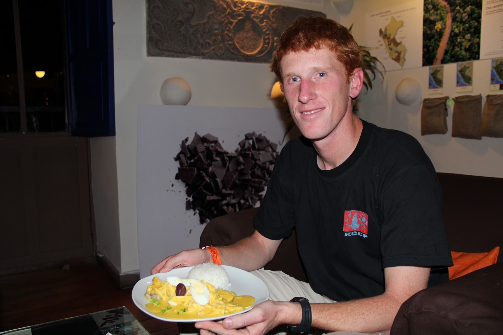
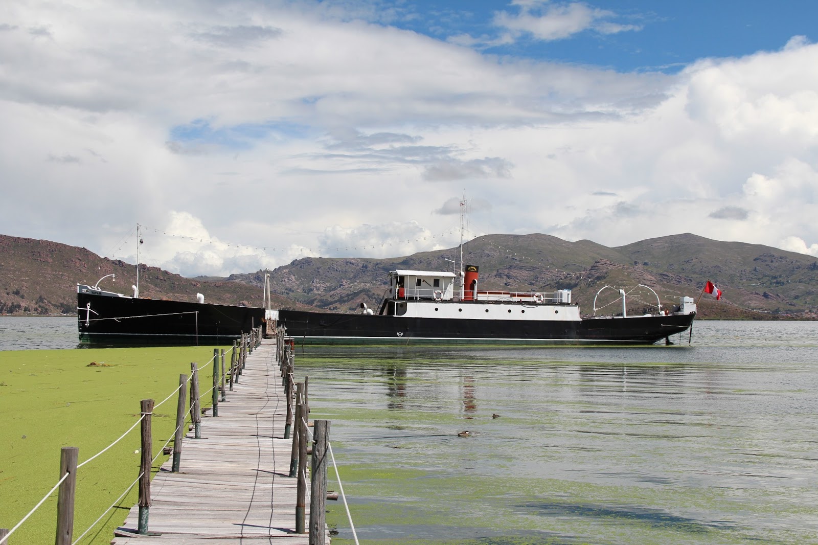
We took a small minibus to Puno, Peru the following day, which is also on Lake Titicaca, and had enough time to visit the Yavari. It's the oldest ship on the lake and was brought by mule from the ocean in over 2700 pieces over 6 years before being completely assembled! We decided against visiting the famous reed islands on the lake because they have been turned into a huge tourist attraction. The Uros, the indigenous people who began living on the islands made of reeds long ago, no longer actually live this way and it is mainly a show for tourists. While some may go for this, several other travelers recommended against it.

The Yavari. The oldest boat on the lake, meant to be a gunboat, that was restored and is now a bed and breakfast.
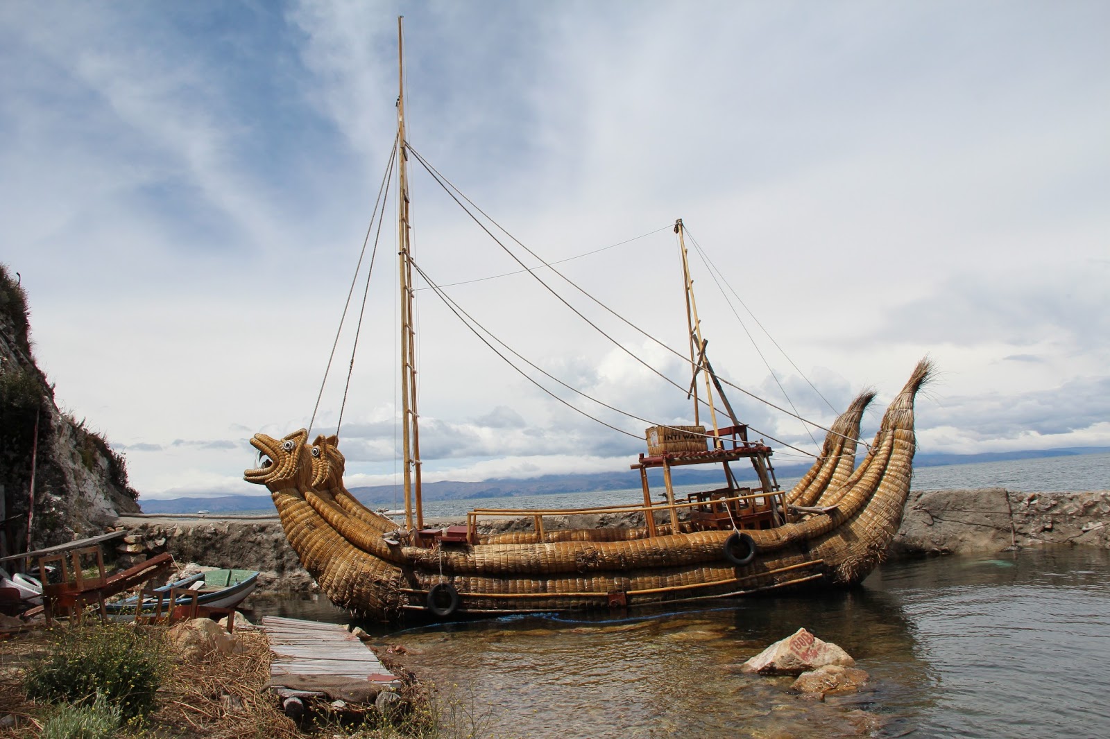
A boat made of the same reeds the Uros make their islands out of on Lake Titicaca.
The area around the lake, although it is split by the border, is almost exactly the same. The same indigenous tribe is split almost half and half by the border and so they barely even recognize it. The people have a very unique style of dress which is nothing like the countries we have previously visited. The women's dress is the most striking, with colorful shawls and their dark long  hair put into two braids with tassles tied at the ends. They cap this off with a hat I can only describe as crosses between top hats and sun hats like that of the Kentucky Derby.

The unique dress of women in the region.
Being a civil engineer, it did somewhat irk me that many of the buildings in this region were unfinished and we couldn't figure out why. It took a conversation with another American who is living in Copacabana to explain that taxes are lower if a structure is unfinished. This causes many of the people to make their buildings appear unfinished so they can receive the lower tax rate. Therefore, you can walk down the block and see most of the buildings with rebar coming out of the top as if another floor was supposed to be built. This is kind of the opposite as in the U.S. where you only have a certain amount of time to complete the project before the building permit is rejected.

Here some construction workers are actually working on another portion of a building. Usually, many buildings have this rebar jutting out of the top to maintain the appearance that the building isn´t finished.
Now that we are finally about acclimated to the altitude here, it's time to leave for Arequipa (several thousand feet lower) and Peru's canyon country, which is home to the two deepest canyons in the world, Colca Canyon and Cotahuasi Canyon. We definitely enjoyed Bolivia and plan to return someday to see more cities and the Salar de Uyuni. It's a beautiful country and by far the least expensive we have visited thus far in South America.

(Written February 28th)


Friday, March 1, 2013

Experiencing the Patagonia

We haven't had a chance to use our tent yet in South America, and heading to the southern Patagonia gave us the perfect excuse. As Sam said when we first arrived in El Calafate, Argentina, this was quite a rugged place. We fit right in with our backpacks and hiking shoes here. El Calafate was only a stopover, though, as we took a bus to Puerto Natales, Chile the next day. This quaint little town serves as the launch point for trekking in the renowned Torres del Paine National Park.

We planned to spend 5 days hiking what's called the "W-route" in the park (named so because it's shaped like a W on the map). Although it's summer in southern Chile right now, we still knew we might have freezing temperatures at night and unpredictable weather with rain and strong winds. On top of that, this was the first time we we trekking while carrying our own packs and all our food with a stove and gas. We felt like the well-known Erratic Rock Hostel in Puerto Natales prepared us well, though, and we were ready to hit the trails.

Our first views from the catamaran.
We arrived into the park and took a catamaran to the west end of the route. Although the first day was only a 3 1/2 hour hike, we were hiking into the wind and weren't used to carrying our packs far yet, so we were exhausted when we arrived.  We woke up the next morning to winds that seemed like they would make our tent collapse (which ended up being a common theme), but we managed to see the nearby glacier, Glacier Grey, up close before hiking on again.

At the farther lookout to see Glacier Grey.
Only one of the scary bridges we crossed on the route.
Hiking back to our camp for our second night.
The campsites were completely packed.
Our third day ended up being the longest, but was definitely rewarding. We hiked 2 1/2 hours with our packs to the start of the French Valley, which is the very middle of the W. We dropped of our bags at the campsite there, and went on with just our day packs up into the valley. This 2 1/2 hour hike one way was arduous, but when we finally reached the top, we had a 360 degree view of peaks all around. We didn't stay but a few minutes due to the freezing winds at the lookout and the ominous sky. We made it back to our packs before the misty rain hit, but we still had a 2 hour hike to reach our camp that night. In the end, we didn't escape getting wet.

We saw an avalanche when hiking in the French Valley.
360 degree views at the French Valley lookout. This was the sunny side...
...but the clouds were definitely coming in from the other direction.
That night, the rain held off, but what we call "Hurricane Cuernos" (the name of that campsite) hit. All of the nights had been windy, but this was the worst of all. We woke up to the howling around 2 am and the stakes had come out of the vestibule doors of our tent and were flapping all around. Sam went to fix them and ended up placing rocks on top of the stakes to help hold the tent in place. He said he saw more than one other person out fixing their own tents. We took in the damage the next morning, with some of our tent poles bent and a broken stake. We weren't the worst off though as at least two different people had their tents ripped or just broken. Someone else said theirs moved at least 2 meters in the middle of the night.

We were up early and off the next day, wanting to escape that campsite. We were met with beautiful sunny weather and a hike through green fields. What we thought was going to be an 8 hour hike turned into only 6 hours because there was a secret short cut that was not on the park's map.

We had some funky clouds this day, but the weather was beautiful.
The horses blocked our way for a few minutes, but we managed to squeeze past.
On the 4th day of hiking, we were rewarded this view of the valley.
The final morning, we woke up and left when it was still dark for the shortest, but steeper hike up to see the main towers of Torres del Paine, saving the best for last. The weather was clear, and although the hike upwards warmed us up, it was quite cold at the top. The peaks rose steeply above us with a small sky blue lake below the rock formations. We were only there to take in the sight, but many climbers take on the peaks as one of the world's best climbing sites. Once our hands were numb and we had taken many pictures, we started the descent to head out of the park. When we had arrived in the park, there was an ere of excitement for the trek. Boarding the bus back to town, we saw tired and sore people limping and hobbling about. For us though, it was all worth it.

The main attraction on our last morning in the park.
Over the next few days, we made our way back into Argentina as we were flying out of El calafate to Bolivia. Before leaving, we took a day to admire the famous Perito Moreno Glacier nearby. The glacier is quite large, at 253 square kilometers, it's larger than the city of Buenos Aires. It stands up to 220 feet above the water and extends up to 330 feet below the water. Perito Moreno is still by no means the largest glacier nearby. Its popularity comes from the fact that it is so accessible and that the glacier is one of few that is growing in size.

We hopped on a few hour bus ride that took us there and stopped to observe the sheep on one of many farms. The Glaciers National Park has walkways that extend over the front face of the glacier, allowing you to get up close and see the brilliant blue colors in the ice formations. Many stand posed with their camera just waiting for ice chunks to fall into the water on a sunny day. We caught a few of these ourselves, as the thunder of the ice cracking and hitting the water is hard to miss.

Catching the falling ice from up close. This happened almost as soon as we entered the park.
Another piece falling. You can´t tell just how big the glacier is unless you´re right in front of it though.

We picnicked in front of the glacier, then opted to take a boat ride to get a different view.  The ride was quite cold, so we stayed inside until we came up to the glacier and could see just how tall it looked from below. When we were on the walkways, we had seen the boats looking so tiny that were headed toward the glacier, and now that was us. In the afternoon warmth, we saw more ice chunks fall and then rode the length of the glacier to see all the formations. Just toward the end, we saw a group of ice trekkers that looked positively tiny. Then we were back to the bus and back to the town of El Calafate for the last time before our flight left in the morning.

 Patagonia gave us a chance to see what the edge of the world has to offer, including some of the most extreme landscape out there. We hope the people who chose to live there don't take it for granted, being that most other places don't have such natural beauty right outside the door. That being said, the weather is absolutely insane! When we heard winds like we did at Cuernos, being from Indiana where tornadoes hit, it was hard for our brain not to continuously tell us there is something wrong.

(Written February 23rd)